
On this day in WNC history: At a 1784 meeting of the NC General Assembly, representatives chartered the first town in western North Carolina: Morganton. Their actions created a judicial and political center and acknowledged the growing influx of settlers into and over the Blue Ridge Mountains.
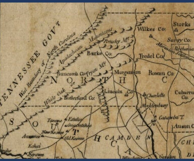
In 1777, Cherokee representatives concluded a treaty with the governments of North Carolina and Virginia, opening a large chunk of land in the foothills of the Blue Ridge to white settlement. In the same year, Burke County was created, followed by Wilkes County in 1778 and Rutherford County in 1779. At this time, all three WNC counties were part of the Salisbury Superior Court District, necessitating substantial travel for some residents. In 1782, these three counties were made part of the new Morgan District, and its superior court sessions were held in an unidentified courthouse in Burke County before the state authorized funding for public structures in this new westernmost district seat.
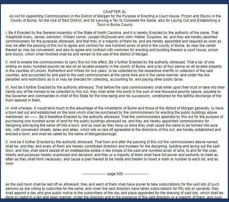
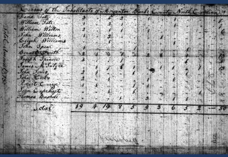
Noting that “ it would tend much to the advantage of the inhabitants of Burke and those of the district of Morgan generally, to have a town laid out and established,” the Assembly tasked district commissioners Waightsill Avery, James Johnston, William Lenoir, Joseph McDowell and John Walker with levying a tax for public buildings on freeholders within the district, and securing 100 acres in a centrally-located spot to construct a court house, jail, and to lay out the beginnings of a town with “acre lots, …convenient streets, lanes and allies [sic].” In the district named for Revolutionary War commander Daniel Morgan, the new town was also named in his honor as “Morgansborough.” Attempting to create an attractive, well-planned town, those who purchased plots within its limits were to build somewhat standardized framed wood or brick homes within three years. The town’s wooden courthouse was finished in 1791. By the 1800 census, Morganton contained only 85 white and 50 enslaved African American residents, comprising barely more than one percent of the county’s total population, yet these numbers were more than double that of Rutherfordton and three and one half times the size of Asheville. Morganton remained an important town, serving as a transportation and political hub, and holding the summer session of the NC Supreme Court (in a new brick building) in the last decades before the Civil War, all while other towns and cities emerged throughout WNC.
1796 map of North and South Carolina, by J. Denison, courtesy State Archives of North Carolina, North Carolina Maps
“An Act for…,” NC Colonial and State Records, 24:604
1800 Census of Morganton
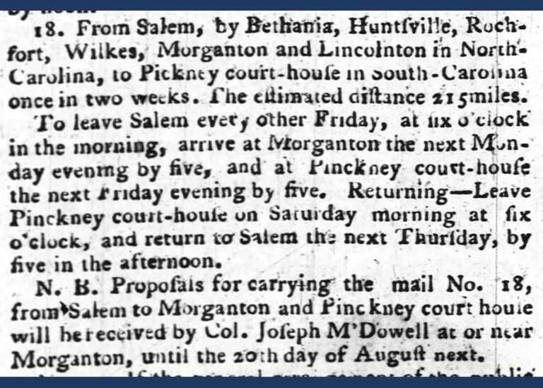
Description of mail routes, North Carolina Gazette, Jul 12, 1794